Navigate:
Top -->South Sierra Nevada
-->Bear Creek (Hogan Dam Road)
Overview :
- Type of trail : Out and Back
- Distance as rode : 6.5 miles
- Total Miles Available : 25+ miles
- Dificulty : Bring the Wife and Kids
- Trail Type : 25% Singletrack; 75% Fireroad
- Cardio : Mild
Highlights :
This is not the trail know as Area 51 or Coyote Point, it is on the oposite
site of the lake. The trail is mostly fireroad with some smallish hills. It can be used as a fast paced training ride, but the hills aren't big enough to be considered hill repeats. This area is used for wintering cattle in the winter time so expect cows on or near the trail between November and May. There is plenty of wildlife including herds of dear, hawks, turkey vultures, SKUNK, and wild turkeys.
Bummer :
Believe it or not, I've had two encounters with cows which spooked me a little. I know cows are silly animals, but when you get 40 or so 1 ton plus animals running in your general direction and a couple of angry bulls you can really respect why they don't have too many problems with predators.
My other problem with this trail is that it's just too easy, there is no challenge here. If you want a fast training ride, or are just looking for a little variety this is a great place. If you want challenging singletrack, forget it.
Location
Lake Hogan is located near Valley Springs, about 22 miles east of Stockton on Hiway 26.
Take 26 East from Stockton to Silver Rapids Road (about 1 mile BEFORE Valley Springs). Turn
right on Silver Rapids and follow it through a housing development until it curves around
and you can see Hogan Dam. Turn right on Hogan Dam road (over the bridge) and follow it for
about 3.5 miles to the Bear Creek day access area. Note after about 2 miles Hogan Dam road
turns into a gravel road. The trailhead is at the end of the parking lot (See the first
image).
Show on Map
Links
A friend of mine took my flying over this area. Here are the Photos I took.
Other trails near here include Coyote Point and Penn Mine.
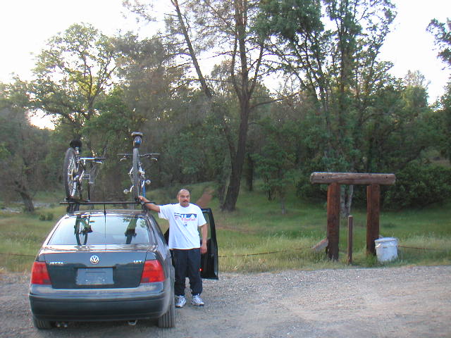
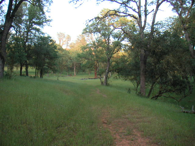
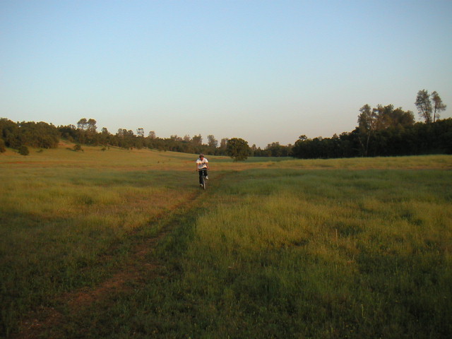
Trailhead
Hey, who's the Barney manhandling my bike!
The trailhead is on the right of the image. I'm not certain that this trail
is intended for mountain bikes, there is no signage to indicate one way or
another. In any case most of the ride is on Fireroad so they can't complain
about trail damage. The little bit of singletrack is abused but large herds of
cattle and a few skid marks here and there don't compare.
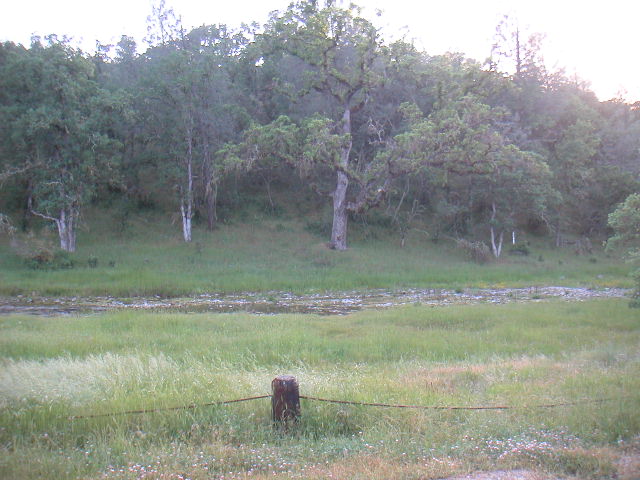
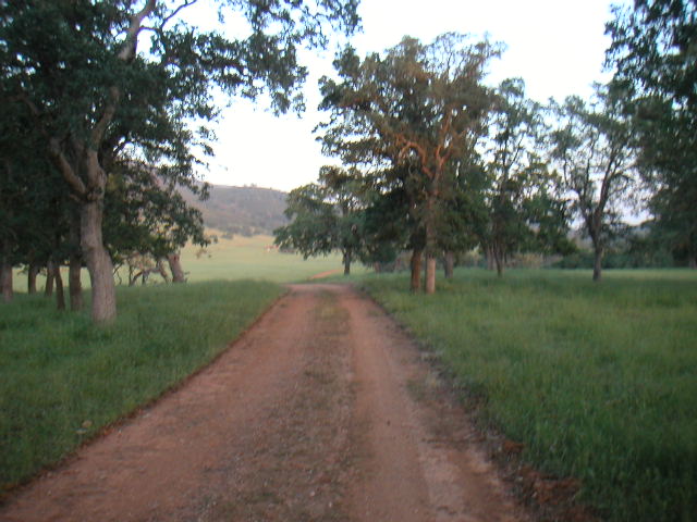
Bear Creek
There it is, Bear Creek. This time of year it is a very attractive little
creek. I think in the summer months it might dry up.
After following the singletrack for about 1/2 mile you will soon come to a cattle gate. You will
need to lift your bike over the fence and walk through the switchback which is
intended to keep the cattle contained (that's my story and I'm sticking to
it).
After crossing the cattle gate Bear creek curves off to the left and there is
a short section of singletrack and a creek crossing. If the creek is flowing you
will see a small waterfall upstream about 100 yards from the creek crossing.
After pausing to admire the waterfall continue down the trail for a couple
hundred more yards to another creek crossing.
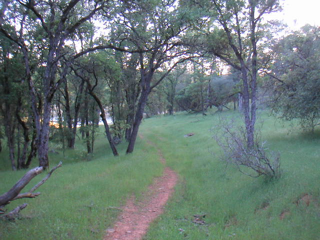
Quite Singletrack
On the far bank of the second creek crossing the trail sort of disappears.
Turn upstream (right) and you will find a quite little patch of singletrack
which follows this (unnamed) creek. This trail will lead you to the fireroad
which most of this trip will follow.
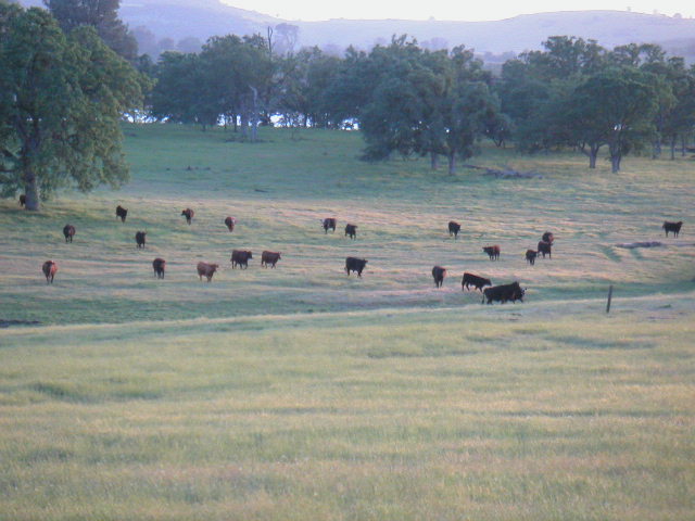
Attack Cows
You can either turn left onto the fireroad or you can use the singletrack/
cow trail that I prefer to take. The singletrack loosely follows the fireroad
and is generally between the fireroad and the lake. The term singletrack is
used rather loosely, as it is primarily a cow track. It is marginally more
challenging to ride than the fireroad but not much.
This early in the evening the cows hide their sinister intent very well.
DownHill !!
We stopped about a mile short of the trailhead to ride down
the gravel downhill to the trailhead. Where we stopped we
found some fireroads going off of the main road. We found about a
mile of rough steep fireroads like these. It was on a fireroad
like this that I broke the seat post on my Sugar 3! This fireroad
is steeper than it looks, and there is no runnout at the bottom
Ambush
If we had only paid attention on our way out we would have noticed this band
of rouge cattle forming an ambush behind us. Fortunately I can still outride
Louis so if did get ugly they could satify their lust for trampling on him.
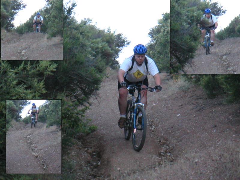
Louis on the Cow Trail
Like I said, it's more of a cow track than singletrack. The trail/ fireroad goes for about 1 1/2- 2 miles before it starts to get a
little hilly. The only thing dangerous about the downhills is loose gravel and
wild cows, so I suggest you hammer up the hills and fly downhill as fast as you
can. There are a couple of spots where the trail is washed out and rutted from
rain runnoff, but otherwise it's full throttle.
Hill Country
I guess the phase hill is a relative term. Louis calls this a big hill, I
call it a large roller, my brother Kevin would call it a speed bump. Most of
the hills on this side of the lake involve less than 100' of climbing so I guess
that makes them rollers.
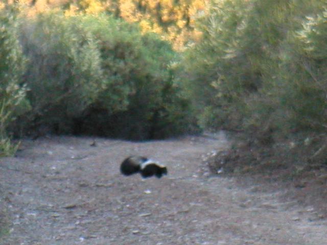
It Wasn't Me
The trails on this side of Hogan are seldom used and there is
plenty of wildlife in the area. I managed to snap this picture before
Pepe there was able to turn around completely. Immediately afterwords
I was forced to make a rapid exit as he started to turn and lift his tail.
The amazing thing about this critter was that he didn't run away like
most wild animals you encounter, he came right up the trail at me until
he was in range. Threatened me with his very potent defenses, and then
when he saw me back down he disappeared into the bushes.
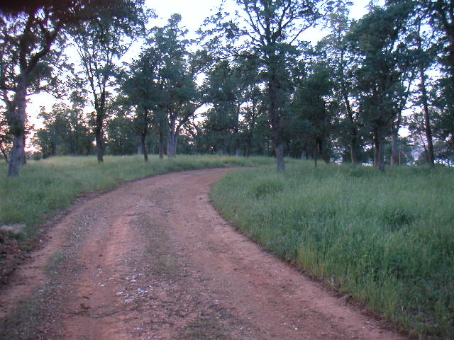
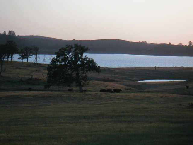
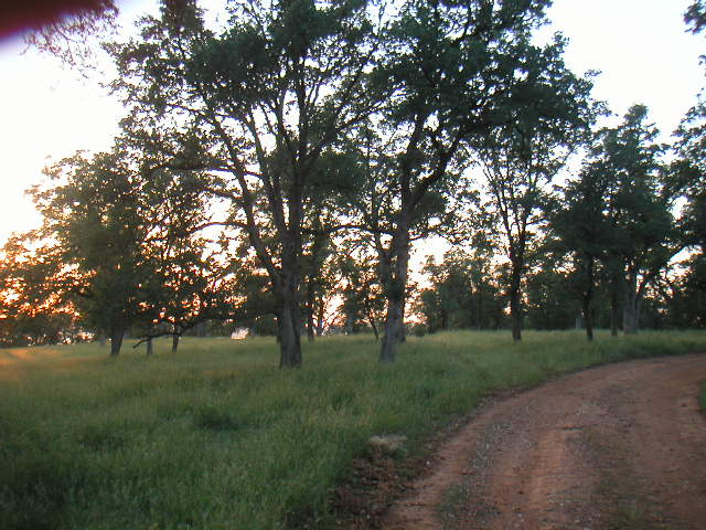
Deviation
About 3 miles into the ride there is a nice stopping place for taking a
snack and letting the kids rest while I catch a few more miles of riding. It's
kind of subtle so you need to watch for it. At the top of the largest of the
rolling hills there is a truck path/ doubletrack that leads off to the left (See
image). If you follow this truck path it will take you to a small peninsula
which is designed for boat campers. There are pit toilets, trash bins and
picnick tables for resting at and possibly taking a small snack.
Wrapup
Even if you don't want to take a break yet the downhill (and climb out) are
probably the most fun of this entire ride and the views of the lake from the peninsula are
great.
Unfortunately on this evening this was our turnaround point, the sun was
getting low and Louis was about done for. I have ridden further down this trail
on other occasions and it gets better as you go further out. Very few people
know about this trail and that means that you don't run into joggers, dogs,
horseback riders, or worse yet, other cyclists.
I don't know exactally how far out the trail goes, I've gone about 7-8 miles
for a totaly trip of ~15 miles, at which point there is a very steep hill with
poor traction and a trained guard cow which convinced me I should turn back.
I am certain I will be riding this trail again because it's so close and my
kids and riding partners just don't have the skill level yet to do more
technical rides. I do genuinely enjoy the peace and tranquillity this trail
offers, sometimes it's great being able to get on your bike and just ride and
not see a soul for a couple of hours.