Navigate:
Top -->Folsom Lake/ Auburn Area
-->Olmstead Loop (Cool)
Overview
- Date Reviewed : June 2002
- Route : Loop
- Distance as rode : 9 miles
- Total Miles (Available) : 9 miles
- Climbing Distance : 600-800 feet (Wild Guess)
- Trip Duration : 1 1/2 Hour Ride time
- Difficulty : 4 (out of 10)
- Trail Type : 70% Fireroad+, 20% Doubletrack, 10% Singletrack
- Cardio : Moderate
Since I rode this trail when I first started getting serious about biking it's a good judge of how much I've progessed. I rode ALL of the hills and didn't clip out for any of the obsticals (Unless you count clipping out to go back, reride and take pictures). I've heard some people refer to this trail as a beginner trail but personally I think this trail is a good ride for any skill level. Better riders can let it rip down the downhills and it is a blast. There are several sections with dropoffs and tough climbs with loose rocks.
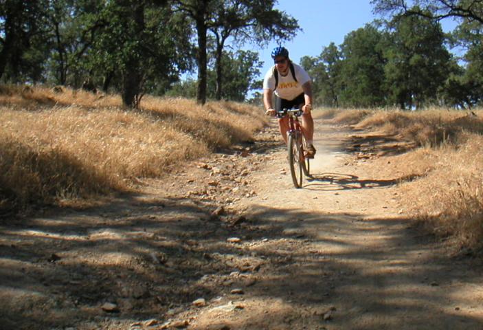
At about 9 miles the Olmstead loop is one of the shorter trails in the Auburn area. However there is a quite a bit of climbing which makes it a take a little more time. The terrain is primarily rolling hills with a couple of moderate climbs thrown in for effect. If you are not in decent shape you will wind up walking the two big hills.
The trail itself is primarily a deeply rutted, rocky, narrow fireroad. The big danger for new riders is getting up to speed on a smooth section of trail and having a tricky section of trail sneak up on you at 25 MPH. There are spots on this trail where panic braking will get you into trouble fast.
Links:
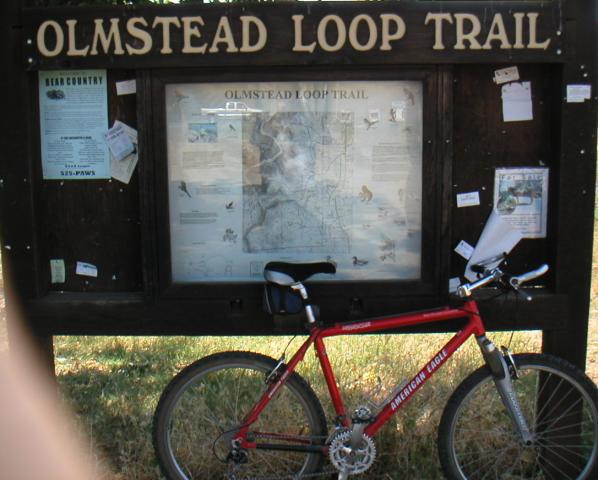
Olmstead Loop
The Olmstead Loop is located in Cool California and is often called simply the Cool Loop. Why it's called Cool when it is actually fairly hot and dry is subject to debate. To get there take Hiway 49 either North from 50 or South from 80 in Auburn to Cool. Once in Cool, look for the Fire Station on the West side of the road. Take the road on the North side of the firestation to the trailhead.
I suggest you cross the road to the trailhead to ride the trail in a counter clockwise fashion. There is a trail map posted near the trailhead. There is non-drinkable water at the trailhead and a mini-mart nearby where you can buy bottled water if you didn't come prepared.
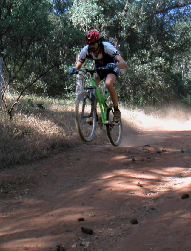
Ok, perhaps not a screaming downhill but it gets pretty wild when you are flying over loose rocks and gravel at 25 MPH. This section of trail is towards the top of the first good downhill. As you can see the grade isn't very steep, however it's easy to get up to high speeds quickly and when you hit a patch of loose stuff like I am about to in the photo you can lose control in a hurry. One thing not to do in the sections of loose rock is panic brake.
Losing traction isn't the only danger though. The second time I rode here a rock flew off of my front tire and smashed my toe bloody through my tough leather MTB shoes. It didn't break anything, but I lost the toenail and it hurt like hell for the rest of the trip. To think, I just read about clip on sandles. What a mess that would have been.
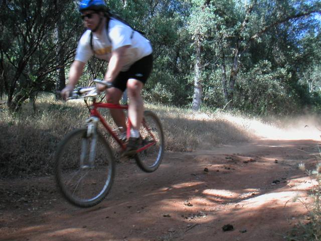
Towards the bottom of the first downhill is this fun dropoff. As a beginner this scared the hell out of me when I came around the corner. This time through I rolled right over it. Almost every time I go back to the trails I haven't been to in a while I am amazed at the difference 6 months of riding can make.
This photo also shows an ample reminder that this is a multi use trail. While out here we encountered several people on horseback. All of them were friendly and didn't seem to mind us at all. We tried to return the favor. Now if only they would teach their overgrown lawnmowers to SH*T in the bushes.
When I took this photo Kevin accused me of over glorifying the trail. "People will think the entire trail is like this". So here is my disclaimer: Read the trail description on the thumbnail page for a general idea of what the trail is like. Check the photos for highlights. I refuse to post 20 boring shots for every fun shot like this one to more accurately depict the ride.
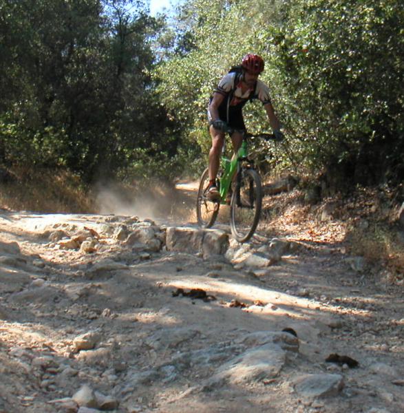
That said, nice air !
Decent air, blurry picture.
I just want to know why I have a goofy expression on every action photo taken of me.
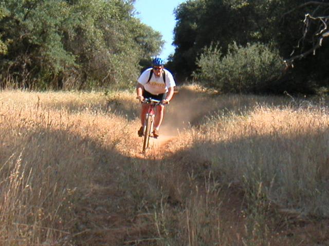
After that nice downhill there is a small creekbed crossing (almost dry right now), a short very steep, technical uphill, then the biggest hill of the ride. For the record I did clip out on this hill, but it was at Kevin's request so he could get the camera from me to take this photo (Most likely this goes back to the idea of more accutately depicting the trail).
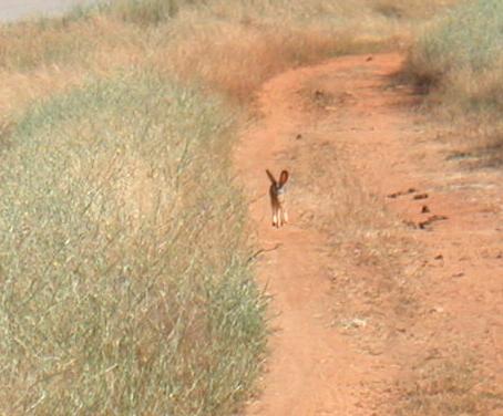
While in Cool we spotted signs of snakes on the trail in several places, saw a hawk, and spotted this rabbit along the trail. Previously we saw a salamander with a bright red streak near the second creek crossing (the creek crossing with water). Although this trail gets quite a bit of traffic, it has plenty of wildlife to remind you that it's not just about bouncing a bike down a dirt path.
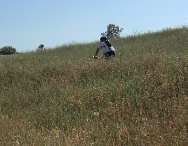
While Kevin was taking pictures of the Rabbit I decided to take the high road around. There are a lot of options on the Olmstead Loop, and many little sections of single track like this which parallel the main trail. Unfortunately the growth you see on either side of the trail I'm riding is star thistle... Ouch.
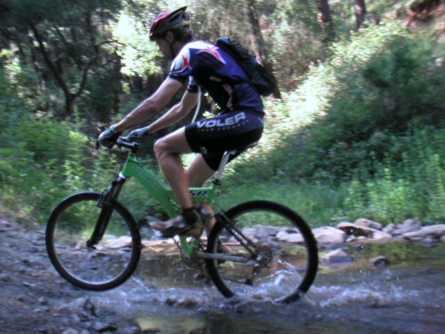
Every trail needs a good creek crossing, and this one delivers. Creek crossings add a bit of flavor to any trail. This particular creek crossing is wet year round. There is one other creekbed crossing which is dry during the summer months.
Immediately before you get to this spot there is a downhill with a steep grade. You get going very fast on the top half of the hill but you need to be careful towards the bottom because the trail gets very loose and rocky and there is a hard right turn at the bottom. The first time I rode this trail the descent scared the heck out of me. Even experienced riders get surprised by this hill.
Double Track
In this photo I'm trucking along at about 25 MPH. I didn't have a trip computer on this bike, but last time I was here I peaked at about 30 MPH. It's hard to see in this photo, but the trail here is actually 2 sections of singletrack worn into deep narrow grooves in the hillside. The trail isn't extremely rough here, but the deep grooves and high speeds make it fun.
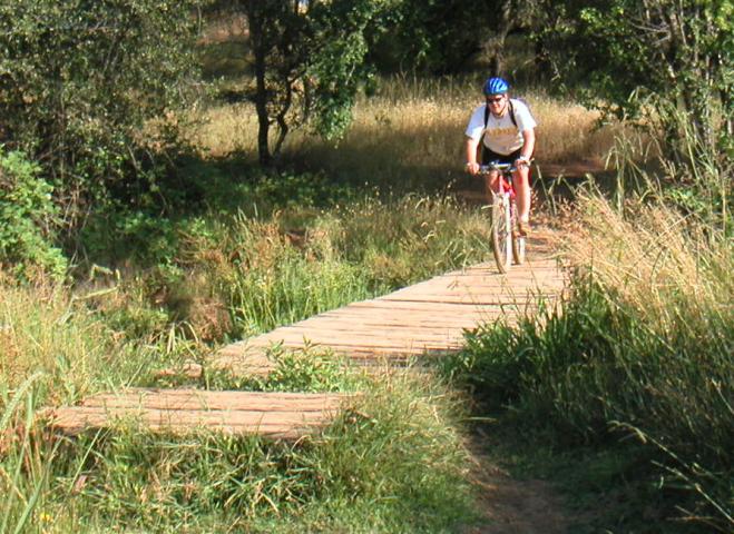
Here is the obligatory bridge shot. Actually, this time of year the creekbed is nearly dry and most people skip the bridge entirely. Overall this is a pretty boring bridge. About the only thing that gives it any character is the missing boards near the center and on this end of the bridge.
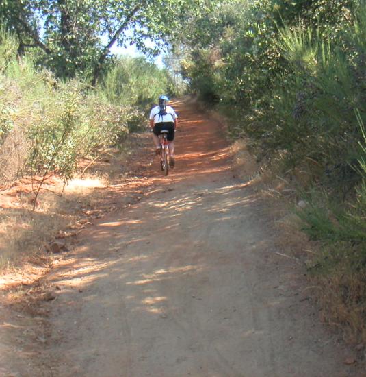
Starting right before the bridge and lasting almost to the end of the trail the character of the trail changes. The ground holds more moisture and the grasses stay green for much longer into the summer. The trail is also very overgrown here and the surrounding area is almost boggy. In the wintertime even on dry days this section is pretty much a mudbath. Right before the final ascent into the parking lot there is a creekbed which is almost impossible to cross in the winter without getting soaked in mud.
Overall when this ride was over I was happy with my progress. Here was a trail which 9 months ago I had to clip out and walk due to trail obsticals and hills which were beyond my endurance. Now I am riding it confidently and while the hills definitely slow me down, they are well within limits. I suppose I could see this trail being classed as a beginners ride, but I enjoy riding a variety of trails and this trail offers enough challenges that I think I will enjoy it for a long time.